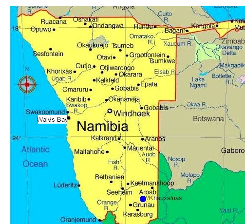
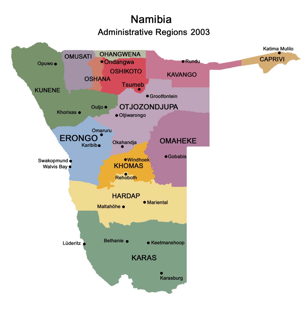
Caprivi is one of the 13 regions of Namibia. It takes its name from the Caprivi Strip which in turn was named after Leo von Caprivi.
Geography
The Caprivi is a tropical area, with high temperatures and much rainfall
during the December-to-March rainy season, making it the wettest region of
Namibia. The terrain is mostly made up of swamps, floodplains, wetlands and
woodland.
In addition to the Zambezi River, the strip also holds the Cuando and Kwando
River, which marks the border with Botswana. Tributaries of the river here
go by different names, including the Linyata and the Chobe. The province's
far eastern is where the Cuando meets the Zambezi.
The region comprises six constituencies: Kongola, Linyanti, Sibinda, Katima
Mulilo Urban, Katima Mulilo Rural, and Kabbe.
Borders
Caprivi is almost entirely surrounded by foreign countries. Its only
domestic border is a short connection in the west with Okavango.
In the northwest, it borders the Cuando Cubango Province of Angola.
In the north, it borders the Western Province of Zambia.
In the south, it borders the North-West District of Botswana.
The Namibia-Zambia-Botswana tripoint lies less than 100 meters from the
Zimbabwe border and as such Namibia is sometimes erroneously thought to
border Zimbabwe.
Flora
and fauna
The region is home to 450 animal species, including elephants, making
Caprivi a popular game-watching spot. The wildlife is protected by several
nature reserves, such as Bwabwata, Mudumu, Lizauli, West Caprivi Game Park,
Mahango Game Reserve, and Mamili National Park; animals travel freely across
the unmarked border with Botswana, where the Chobe National Park lies. The
strip is also a prime bird-watching area, with almost 70 percent of bird
species found in Namibia being recorded here. Katima Mulilo is the largest
city, with other notable towns including Kongola, Chinchimane, Bukalo,
Sibinda, and Impalila.
There are three game parks in the Caprivi region. The Caprivi Game Park is
5,715 square kilometers and extends for about 180 km from the Kavango River
in the west to the Kwando River in the east. Deciduous woodlands are
dominated by trees such as wild seringa, copalwood and Zambezi teak. While
the park is sanctuary to 35 large and numerous small game species, visitors
are not likely to see many of these animals as vehicles are restricted to
the road between Kavango and Eastern Caprivi. Animals likely to be seen are
elephant, roan and kudu, buffalo occur towards the west. As many as 339 bird
species have been recorded in west Caprivi. The wild and little visited
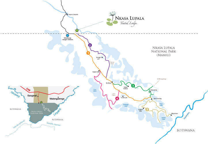
Mamili National Park is Namibia's equivalent of the Okavango Delta, a watery
wonderland of wildlife rich islands, river channels and wetlands. The focal
points of the 320km2 national park are Nkasa and Lupala, two large islands
in the Kwando/Linyati river. During the dry season the islands can be
reached by road but after the rains 80% of the area becomes flooded, cutting
them off from the mainland. Mudumu National Park is a vast 100,959 hectare
expanse of dense savannah and mopane woodland with the Kwando River at its
western border. The park is home to small populations of sitatunga and red
lechwe while spotted neck otter, hippo and crocodile inhabit the waterways.
Animals to be encountered are elephant, buffalo, roan, sable, kudu, impala,
oribi, zebra, wild dog as well as some 430 species of birds.
History
Until the end of the 19th century, it was known as Itenge and it was under
the rule of the Lozi kings. In the late 19th century the strip of land was
administered as part of the British protectorate of Bechuanaland (Botswana).
The German Empire in 1890 laid claim to the British-administered island of
Zanzibar; Britain objected and the dispute was settled at the Berlin
Conference later that year. On July 1, 1890, the British acquired Zanzibar
and Germany acquired the territory which became known as the Caprivi Strip.
Caprivi was named after German Chancellor Leo von Caprivi, who negotiated
the land in an 1890 exchange with the United Kingdom. Leo von Caprivi
arranged for Caprivi to be annexed to German South-West Africa in order to
give Germany access to the Zambezi River as part of the Heligoland-Zanzibar
Treaty. The German motivation behind the swap was to acquire a strip of land
linking German South-West Africa with the Zambezi River, providing easy
access to Tanganyika (Tanzania) and an outlet to the Indian Ocean.
Unfortunately for the Germans, the British colonisation of Rhodesia
(Zimbabwe and Zambia) stopped them well upstream of Victoria Falls, which
proved a considerable barrier to navigation on the Zambezi.
During World War I, the Caprivi Strip again came under British rule and was
governed as part of Bechuanaland but it received little attention and became
known as a lawless frontier. Today approximately 66,000 people live in the
Caprivi, mostly as subsistence farmers who make their living on the banks of
the Zambezi, Kwando, Linyati and Chobe Rivers.
The strip became of geopolitical importance during the 1980s when it was
used as a jumping off point and re-supply route for South African support
for the UNITA movement in Angola.
Ethnography
About 80,000 people live in Caprivi, about four percent of Namibia's
population. About 17,000 are part of the Lozi ethnic group of 556,000
people, who also live in western Zambia, northwest Zimbabwe (70,000), and
northern Botswana (14,000). According to the Ethnologue, the Lozi language
is "spoken as lingua franca by all East Caprivians."
There has been ethnic tension between the Lozis and the Ovambos, the
majority ethnic group of northern Namibia. This has led to past conflict,
including the 1994 formation of the Caprivi Liberation Front, which pushes
for Caprivi-Lozi self-rule.
Capital:
Katima Mulilo
Largest city:
Katima Mulilo
Politics
Governor: Leornard Mwilima (SWAPO)
Ruling party: SWAPO
Representaion in regional government
(6 seats): SWAPO
Last elections: 2008
Next elections: 2012
Population: 90 422
Population density: 4.62 persons/km²
Languages: Silozi, Oshiwambo, English, Afrikaans
Geography
Area: 19,532 km²
of it forested: approx 15,000 km² (70 %)
Rank: 10th of 13 regions
Administrative divisions
Constituencies: 6
Cities: 1
Coordinates: 17°30'S 24°16'E
To print this page press Ctrl-P
Contact:
E-mail:
info@namibweb.com
Reservations are only accepted in writing: by fax or via e-mail.
Final availability confirmation: in writing: by fax or via e-mail.
Terms & conditions, Payment options and Cancellation policy
![]()
![]()
![]()
Page created and serviced by
![]()
www.namibweb.com
Copyright © 1998-2025
namibweb.com - The online guide
to Namibia
All rights reserved |
JOIN
|
VIDEO PORTFOLIO
|
VIDEO/PHOTO COLLECTION
Telegram
| YouTube |
Blog
Page is sponsored by ETS &
Exploring Namibia TV
Disclaimer: no matter how often this page is updated and its accuracy is checked,
www.namibweb.com and ETS
will not be held
responsible for any change in opinion, information, facilities, services,
conditions, etc. offered by
establishment/operator/service/information provider or any third party