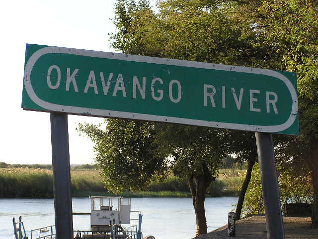
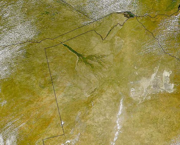
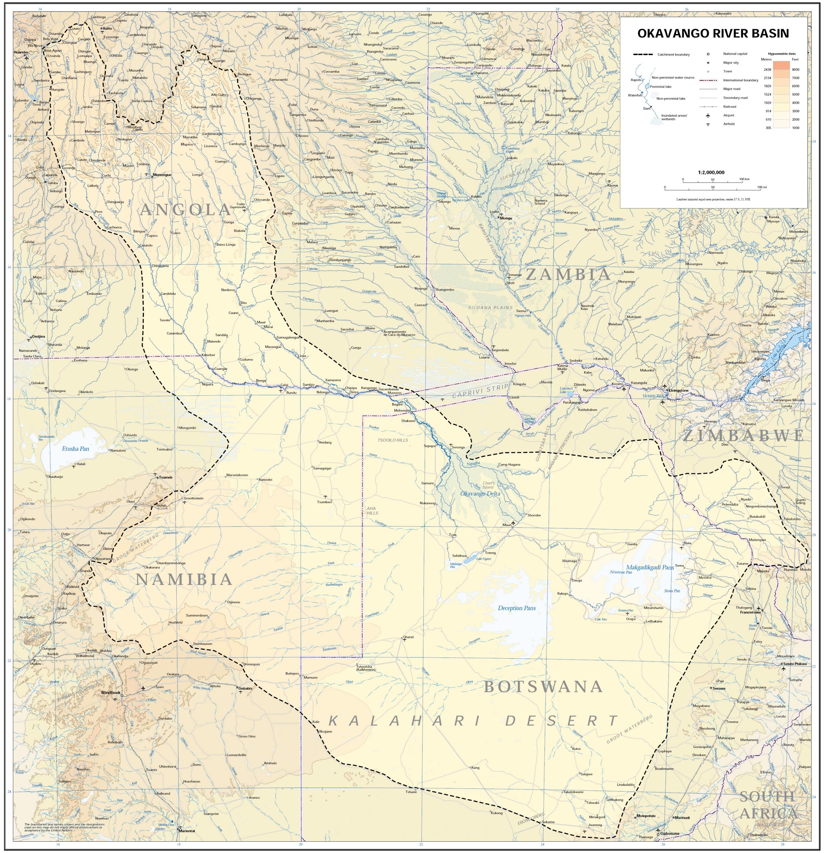
The Okavango Delta (or Okavango Swamp),
in Botswana, is the world's largest inland delta. It is formed where the
Okavango River empties onto a swamp in an
endorheic
basin in the Kalahari Desert, where most of the water is lost to evaporation
and transpiration instead of draining into the sea. Each year approximately
11 cubic kilometres of water irrigate the 15,000 km² area and some
flood-waters drain into Lake Ngami. The Moremi Game Reserve,
a National Park, spreads across the eastern side of the delta.
The area was once part of Lake Makgadikgadi, an ancient lake that mostly
dried up by the early Holocene.
Floods
The Okavango Delta is produced by seasonal flooding. The Okavango river
drains the summer (January–February) rainfall from the Angola highlands and
the surge flows 1,200 kilometres in approximately one month. The waters then
spread over the 250 km by 150 km area of the delta over the next four months
(March - June).
YouTube video of Mopiri Camp,
Etsha Village, Okavango
Delta:
The high temperature of the delta causes rapid transpiration
and evaporation, resulting in a cycle of rising and falling water level that
was not fully understood until the early 20th century. The flood peaks
between June and August, during Botswana’s dry winter months, when the delta
swells to three times its permanent size, attracting animals from kilometres
around and creating one of Africa’s greatest concentrations of wildlife.
The delta is very flat, with less than 2 metres variation in height across
its 15,000 km².
Where the water goes
Every year, circa 11 cubic kilometres (11,000,000,000,000 litres) of water
flow into the delta. Approximately 60% is consumed through transpiration by
plants, 36% by evaporation, 2% percolates into the aquifer system; and 2%
flows into Lake Ngami. This turgid outflow means that the delta is unable to
flush out the minerals carried by the river and is liable to become
increasingly salty and uninhabitable, but this effect is reduced by the low
salt content which collects around the roots of the plants. The low salinity
of the water also means that the floods do not greatly enrich the floodplain
with nutrients.
The agglomeration of salt around plant roots means that many of the
thousands of islands have barren white patches in their centre, which have
become too salty to support plants, aside from the odd salt resistant palm
tree. Trees and grasses grow in sand near the edges of the islands that has
yet to become too salty.
Approximately 70% of the islands began as termite mounds, where a tree then
takes root on the mound of earth.
Chief’s Island
Chief’s Island, the largest island in the delta, was formed by a fault line
which uplifted an area over 70 km long and 15 km wide. Historically it was
reserved as an exclusive hunting area for the chief. It now provides the
core area for much of the resident wildlife when the waters rise.
Climate
The Delta's profuse greenery is not the result of a tropical climate, rather
it is an oasis in an arid country. The average annual rainfall is 450mm
(approximately one third that of its Angolan catchment area) and most of it
falls between December and March in the form of heavy afternoon
thunderstorms.
YouTube video of
Kwando Splash Camp,
Okavango
Delta:
December to February are hot wet months with daytime temperatures as high as
40°C, warm nights, and humidity levels fluctuating between 50 and 80%. From
March to May the temperature becomes far more comfortable with a maximum of
30°C during the day and mild to cool nights. The rains quickly dry up
leading into the dry, cold winter months of June to August. Daytime
temperatures at this time of year are mild to warm but the temperature begin
to fall after sunset. Nights can be surprisingly cold in the Delta with
temperatures barely above freezing.
September to November sees the heat and atmospheric pressure build up once
more as the dry season slides into the rainy season. October is the most
challenging month for visitors - daytime temperatures often push past 40°C
and the dryness is only occasionally broken by a sudden cloudburst.
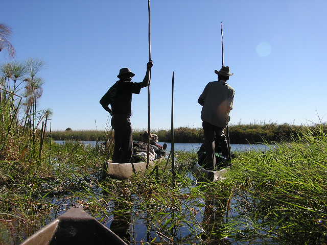
Wildlife
The Okavango delta is both a permanent and seasonal home to a wide variety
of wildlife which is now a popular tourist attraction.
Species include African Bush Elephant, African Buffalo, Hippopotamus, Lechwe,
Topi, Blue Wildebeest, Giraffe, Nile crocodile, Lion, Cheetah, Leopard,
Brown Hyena, Spotted Hyena, Greater Kudu, Sable Antelope, Black Rhinoceros,
White Rhinoceros, Plains Zebra, Warthog and Chacma Baboon. Notably the
endangered African Wild Dog still survives within the Okavango Delta,
exhibiting one of the richest pack densities in Africa. The delta also
includes over 400 species of birds, including African Fish Eagle, Crested
Crane, Lilac-breasted Roller, Hammerkop, Ostrich, and Sacred Ibis.
The majority of the estimated 200,000 large mammals in and around the delta
are not year-round residents. They leave with the summer rains to find
renewed fields of grass to graze on and trees to browse, then make their way
back as winter approaches. Large herds of buffalo and elephant total about
30,000 beasts.
Fish
The Okavango Delta is home to 71 fish species including Tigerfish, Tilapia
and Catfish. They range from 1.4 m Sharptooth-Catfish to 3.2 cm Sickle-fin
Barb. The same species are to be found in the Zambezi River, indicating a
historic link between the two river systems.
The most populous large mammal is the lechwe antelope, with more than
60,000. It is a little larger than an impala with elongated hooves and a
water repellent substance on their legs that enables rapid movement through
knee deep water. They graze on aquatic plants and, like Waterbuck, take to
water when threatened by predators. Only the males have horns.
Papyrus and reed rafts make up a large part of the Okavango's vegetation.
During the flood season they float well above the sandy river bed with roots
dangling free in the water. This gap between bed and roots is utilised as
shelter by crocodiles. The plants of the Delta play an important role in
providing cohesion for the sand. The banks or levees of a river normally
have a high mud content and this combines with the sand in the river’s load
to continuously build up the river banks. In the Delta, because of the clean
waters of the Okavango, there is almost no mud and the river’s load consists
almost entirely of sand. The plants capture the sand, acting as the glue and
making up for the lack of mud and in the process creating further islands on
which more plants can take root.
This process is important in the formation of linear islands. They are long
and thin and often curved like a gently meandering river. The reason for
that is that they are actually the natural banks of old river channels which
over time have become blocked up by plant growth and sand deposition,
resulting in the river changing course and the old river levees becoming
islands. Due to the flatness of the Delta, and the large tonnage of sand
flowing into it from the Okavango River, the floor of the delta is slowly
but constantly rising. Where channels are today, islands will be tomorrow
and then new channels may wash away these existing islands.
The Botswana Okavango Game Lodges (2011) cater for small numbers of guests,
each one operating in its own Okavango Delta private concession area. There
are a huge number of lodges with low impact policies to the environment.
People
The Okavango Delta peoples consist of five ethnic groups, each with its own
ethnic identity and language. They are Hambukushu (also known as Mbukushu,
Bukushu, Bukusu, Mabukuschu, Ghuva, Haghuva), Dceriku (Dxeriku, Diriku,
Gciriku, Gceriku, Giriku, Niriku), Wayeyi (Bayei, Bayeyi, Yei), Bugakhwe (Kxoe,
Khwe, Kwengo, Barakwena, G/anda) and ||anikhwe (Gxanekwe, //tanekwe, River
Bushmen, Swamp Bushmen, G//ani, //ani, Xanekwe). The Hambukushu, Dceriku,
and Wayeyi are all Bantus who have traditionally engaged in mixed economies
of millet/sorghum agriculture; fishing, hunting, and the collection of wild
plant foods; and pastoralism.
The Bugakhwe and ||anikwhe are Bushmen who have traditionally practised
fishing, hunting, and the collection of wild plant foods; Bugakhwe utilized
both forest and riverine resources while the ||anikhwe mostly focused on
riverine resources. The Hambukushu, Dceriku, and Bugakhwe are present along
the Okavango River in Angola and in the Caprivi Strip of Namibia, and there
are small numbers of Hambukushu and Bugakhwe in Zambia as well. Within the
Okavango Delta, over the past 150 years or so Hambukushu, Dceriku, and
Bugakhwe have inhabited the Panhandle and the Magwegqana in the northeastern
Delta. ||anikhwe have inhabited the Panhandle and the area along the Boro
River through the Delta, as well as the area along the Boteti River.
The Wayeyi have inhabited the area around Seronga as well as the southern
Delta around Maun, and a few Wayeyi live in their putative ancestral home in
the Caprivi Strip. Within the past 20 years many people from all over the
Okavango have migrated to Maun, the late 1960s and early 1970s over 4,000
Hambukushu refugees from Angola were settled in the area around Etsha in the
western Panhandle.
The Okavango Delta has been under the political control of the Batawana (a
Tswana sub-tribe) since the late 18th century. Most Batawana, however, have
traditionally lived on the edges of the Delta. Small numbers of people from
other ethnic groups such as Ovaherero and Ovambanderu now live in parts of
the Okavango Delta, but since the majority of the members of those groups
live elsewhere and the habitation is recent they are not considered as part
of the Okavango Delta peoples. There are also several Bushmen groups
represented by a handful of people. These groups were decimated by diseases
of contact in the middle part of the 20th century, and most of the remaining
members have intermarried with the ||anikwhe.
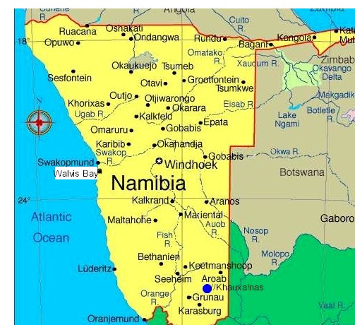
Hydropower proposals
The Namibian government has presented plans to build a hydropower station in
the Caprivi Region, which would regulate the Okavango's flow to some extent.
While proponents argue that the effect would be minimal, environmentalists
argue that this project could destroy most of the rich wildlife and plant
life in the Delta.
 endorheic
basin in the Kalahari Desert, where most of the water is lost to evaporation
and transpiration instead of draining into the sea. Each year approximately
11 cubic kilometres of water irrigate the 15,000 km² area and some
flood-waters drain into Lake Ngami. The Moremi Game Reserve,
a National Park, spreads across the eastern side of the delta.
endorheic
basin in the Kalahari Desert, where most of the water is lost to evaporation
and transpiration instead of draining into the sea. Each year approximately
11 cubic kilometres of water irrigate the 15,000 km² area and some
flood-waters drain into Lake Ngami. The Moremi Game Reserve,
a National Park, spreads across the eastern side of the delta.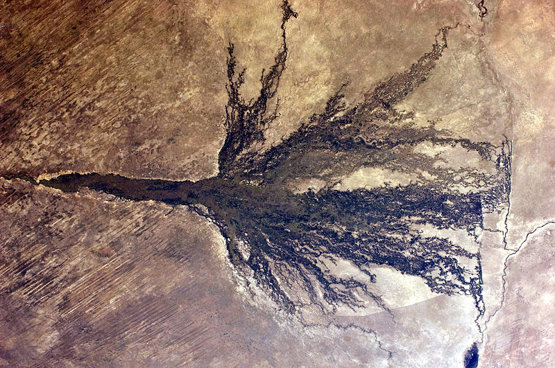